

Greenwich is one of the best corners of London for a dog. You get a Royal Park, open heath, ancient woodland, riverside promenade and a scatter of council parks all inside a few square miles of SE postcodes.
These eight walks cover the lot: mud-free pushchair routes, longer woodland rambles, and quiet loops for dogs who prefer not to meet forty other dogs on a Sunday.
A quick word on how these were built. The routes here are community built, machine-routed on the OpenStreetMap foot network (BRouter). They are not personally tested unless a walk says otherwise, so treat distances and terrain as a solid guide rather than a boots-on-the-ground report.
Access rules are cited to their source and were last checked in early 2026. Byelaws and Public Spaces Protection Orders (PSPOs) get updated, so glance at on-site signage before you rely on anything below.
Tip: On hot days, carry your own water. General vet welfare advice is clear that dogs overheat fast, and most of these walks have no guaranteed drinking source on the route.

Quick decision table: which Greenwich walk suits your situation
| Your situation | Walk to pick |
|---|---|
| Rainy day, want low mud | Blackheath Circuit or Thames Path |
| Pushchair or pram | Thames Path: Cutty Sark to the O2 |
| Reactive dog, want quiet | Charlton Park & Hornfair Park Circuit |
| Big or older dog, no steep climbs | Blackheath Circuit |
| Proper woodland adventure | Oxleas Wood Loop |
| Short leg-stretch near the DLR | Greenwich Park Loop |
| Varied terrain in one loop | Maryon Park & Maryon Wilson Park Woods Loop |
| Common plus riverside contrast | Woolwich Common to Royal Arsenal Riverside |
Greenwich Park Loop
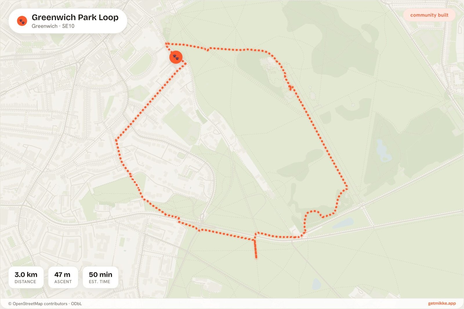
2.97 km · 47 m ascent · Parkland, surfaced paths and grass · Mixed (Royal Parks rules) · Greenwich / Maze Hill · Pay & display off Blackheath Gate · Drinking fountains near the Pavilion Café · mud: Low
The obvious starting point, and rightly so. This is a tidy loop through a walled Royal Park with the river and the Observatory as backdrop.
Dogs generally do not need a lead here under the Royal Parks and Other Open Spaces Regulations 1997, but you must keep them under effective control at all times (royalparks.org.uk). The Flower Garden, the Wilderness Deer Paddock and the Royal Observatory Garden are no-dogs zones entirely, not just leads-on.
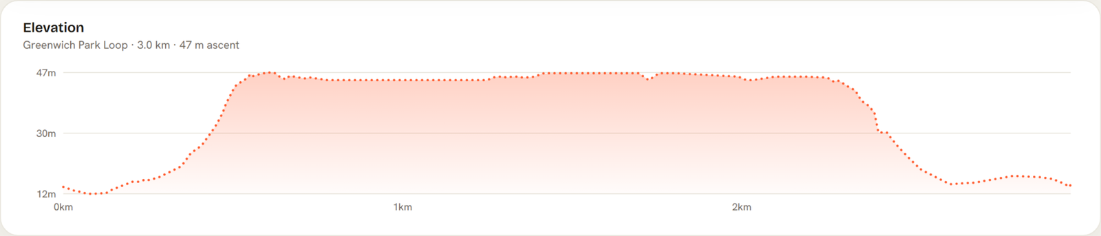
There is a steady 47 m pull up to the Observatory, which is the one bit of real effort on an otherwise gentle loop. The reward is the view back over the river.
Mud stays low thanks to paved avenues and close-mown grass. Fountains sit near the Pavilion Café, which takes dogs at its outside tables.
THE HONEST DOWNSIDE: Weekends are heaving, and the Flower Garden, deer paddock and Observatory Garden are strictly no-dogs zones, not just leads-on. The Royal Parks also advises steering clear of the deer area during the autumn rut (roughly September to November; last checked early 2026), so check current signage before letting your dog roam near it.
Thames Path: Cutty Sark to the O2
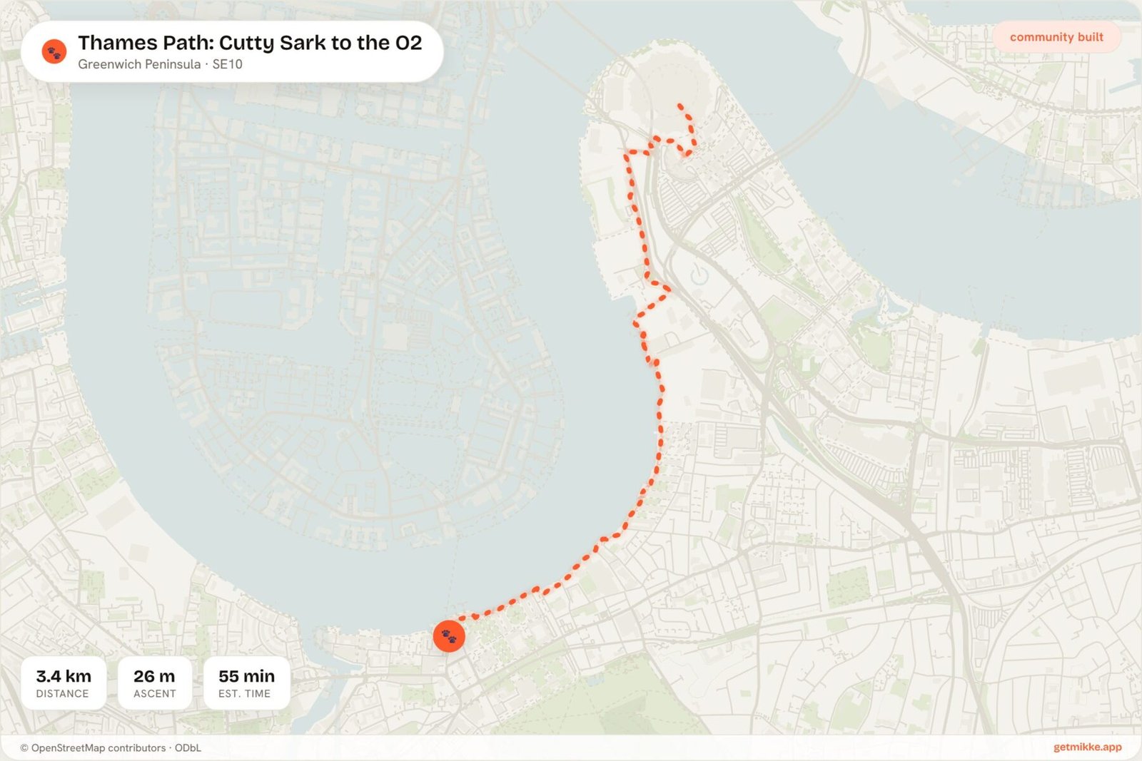
3.41 km · 26 m ascent · Flat riverside, fully surfaced · On lead (advised) · Cutty Sark DLR / North Greenwich · None practical (best reached by DLR) · Cafés en route · mud: Low
Where the park loop climbs and curls, this one is dead flat and dead straight. It is the pushchair and wet-weather pick of the whole list.
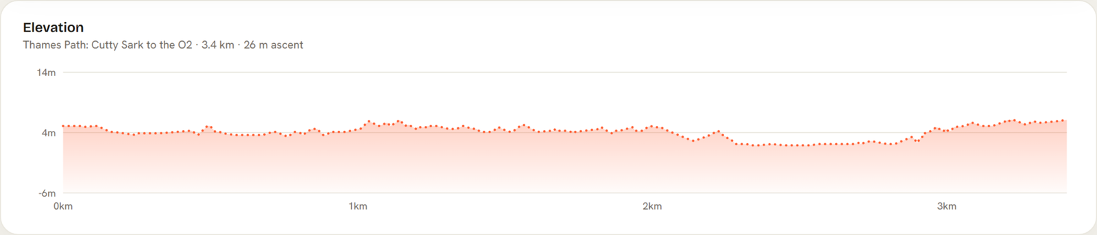
The path is fully surfaced from start to finish, with barely 26 m of rise across the whole stretch. That makes it the best option here for prams, wheelchairs or an older dog with tired hips.
This is a lead-only walk in practice, though it is guided by general safety advice rather than a specific by-law. TfL and the Port of London Authority both stress keeping dogs under close control near cyclists and around the tidal river, and there is genuinely nowhere sensible to let one off anyway.
At low tide, steps lead down to the foreshore and some dogs enjoy a paddle. Check PLA tide times first and obey any local no-access signs, because the mud down there is a different beast to the path.
THE HONEST DOWNSIDE: Linear, busy with cyclists and joggers, and there is nowhere sensible to let a dog off the lead. Skip parking entirely and take the DLR.
Maryon Park & Maryon Wilson Park Woods Loop
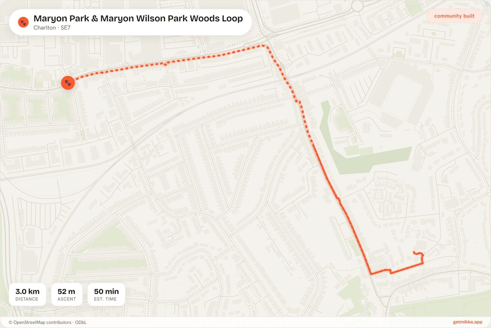
3.02 km · 52 m ascent · Mixture of steep woodland paths, park lawns and steps; some paths can be muddy · Check locally · Charlton · Limited on-street parking on local roads · No official water points, bring your own · mud: Moderate
After the flat riverside slog, this is the opposite: two connected, lesser-known Charlton parks with real up-and-down. Woodland, slopes and open grass in one route give a dog properly varied exercise.
These are council parks, so dogs are welcome under the Royal Borough of Greenwich parks rules (dogs under control, max four per walker). Off-lead status here is marked check locally, so treat open grass as off-lead subject to control and lead up near playgrounds and enclosed sports areas.
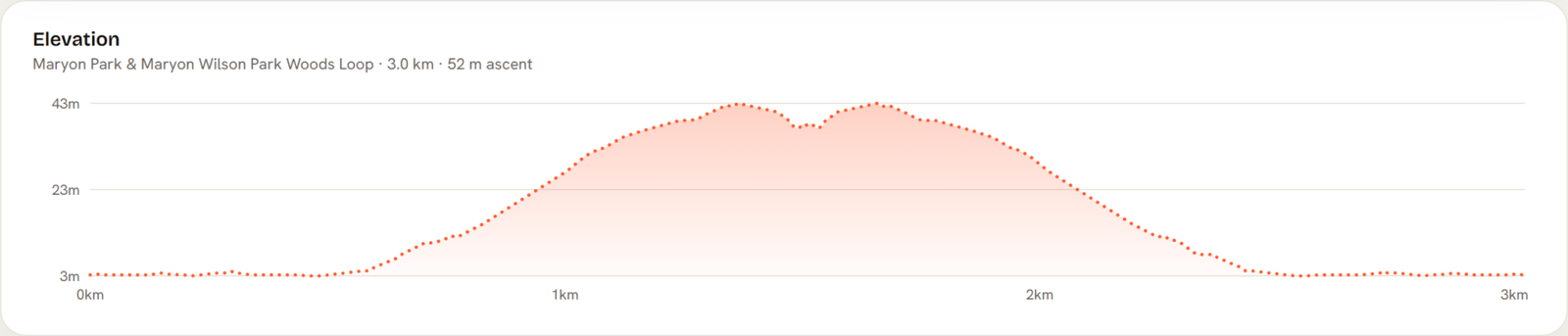
There is 52 m of climbing packed into three kilometres, much of it on steps and steep woodland paths. It feels punchier than the figure suggests.
There is no official water source on this loop, so bring your own, especially in summer.
THE HONEST DOWNSIDE: Steep sections and steps can be hard going for owners with mobility issues, paths can be slippery after rain, and some spots feel secluded with limited lighting. Not one for after dark.
Eltham Park South & Shepherdleas Wood Loop
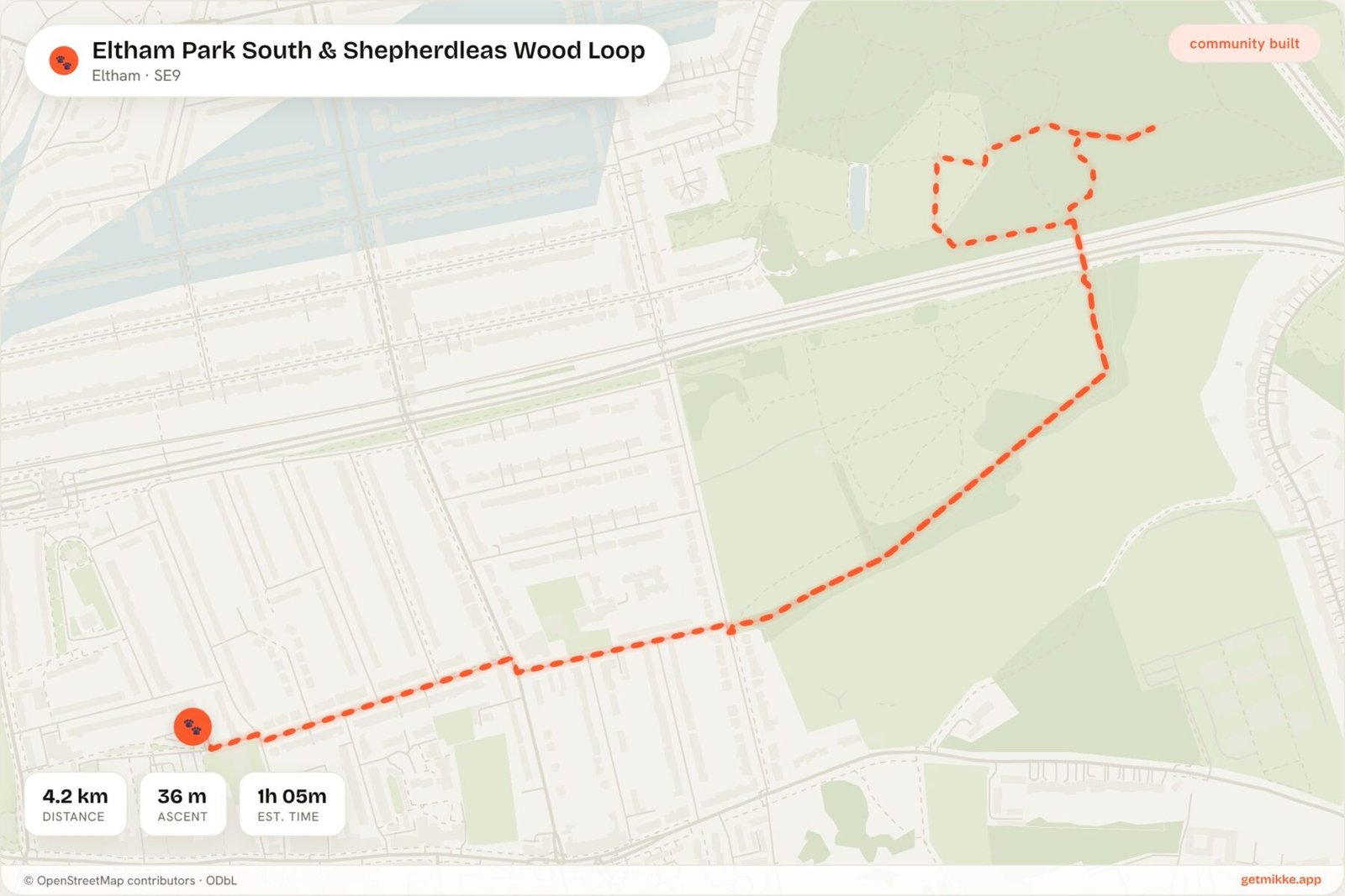
4.2 km · 36 m ascent · Park lawns and tarmac paths plus natural ancient woodland tracks; some gentle slopes, can be muddy · Check locally · Eltham · Small car park at Eltham Park South; on-street parking nearby · Park kiosk; more cafés and pubs on Eltham High Street · mud: Moderate
Where Maryon throws steps and steep bits at you, this Eltham loop is longer and far gentler underfoot. It pairs open grass for ball games with shady ancient woodland to explore.
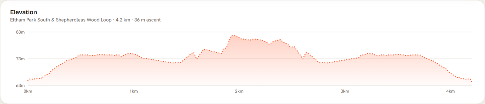
The gradients here are soft. Just 36 m of rise is spread across 4.2 km, so it never feels like a climb.
This is council land under the same Greenwich parks rules, with off-lead status marked check locally. The open lawns work well for recall practice; the woodland less so.
There is a small car park at Eltham Park South itself, which is a rarer luxury than it sounds around here.
THE HONEST DOWNSIDE: Woodland paths become boggy in winter, are not waymarked, and can feel enclosed, which some owners find harder for recall training. Bring a phone map for the tree sections.
Oxleas Wood Loop
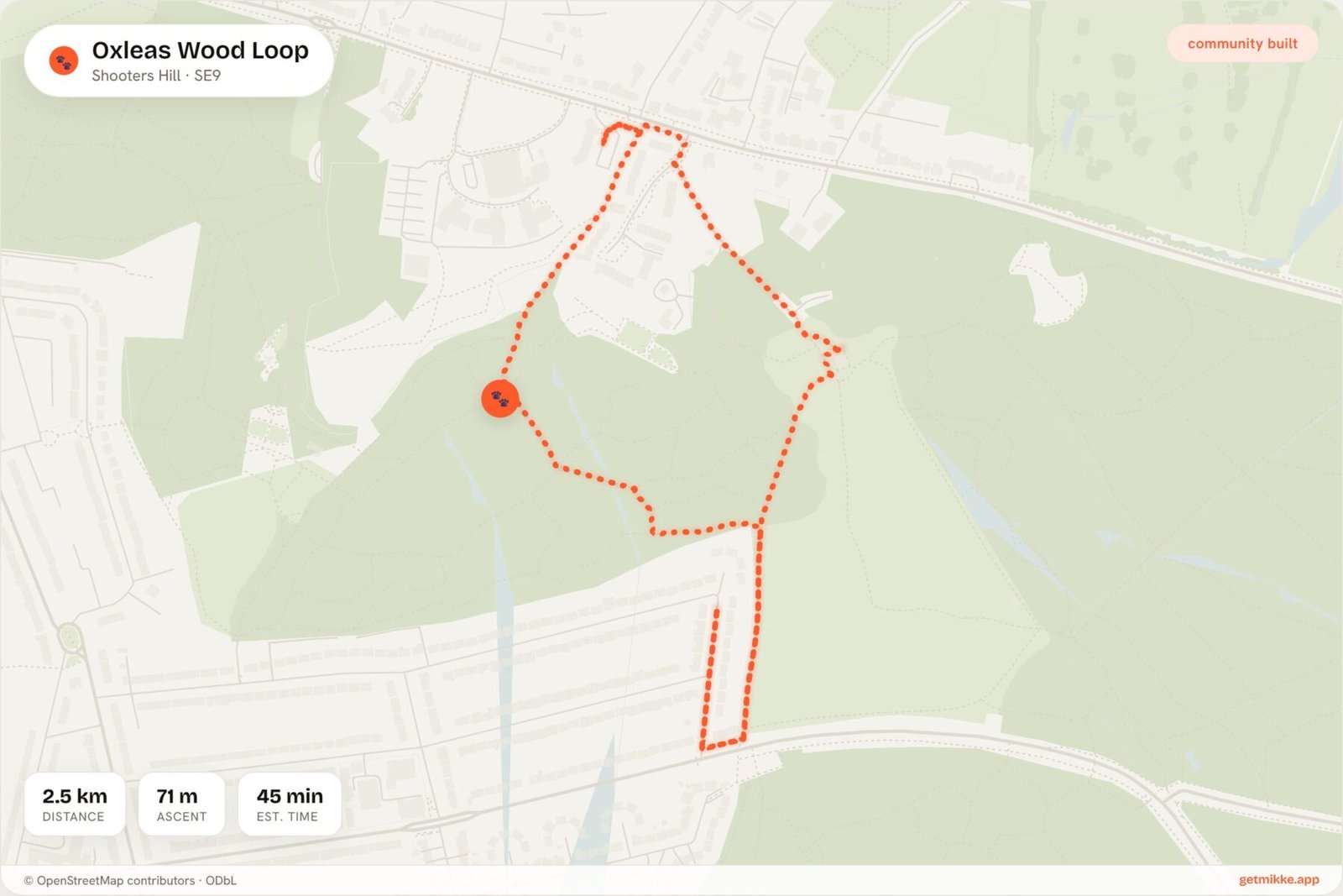
2.47 km · 71 m ascent · Ancient woodland, unsurfaced paths · Check locally · Falconwood · Free car park off Crown Woods Lane · None in the woods · mud: High
The Shepherdleas loop dips into ancient woodland. Oxleas commits to it fully. This is a proper woodland walk on Shooters Hill, all roots, leaf litter and a genuine sense of being out of the city.
Crucially for anyone with a large or arthritic dog, there are no stiles on the usual circuits here, just standard woodland gates and open paths. That makes it a strong pick where climbing over stiles is a problem.
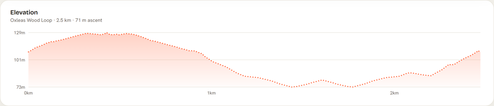
The trade-off is the climb. There is 71 m of ascent in under two and a half kilometres, the steepest ratio on this list.
This is council open space under the Royal Borough of Greenwich parks rules, off-lead status marked check locally, so keep control on the busier meadow paths. The Oxleas Wood Café at the meadow viewpoint usually has bowls out, which is handy because there is no water in the woods themselves.
THE HONEST DOWNSIDE: Seriously muddy from October to April. This is a wellies-and-towel walk, not a quick clean stroll.
Woolwich Common to Royal Arsenal Riverside
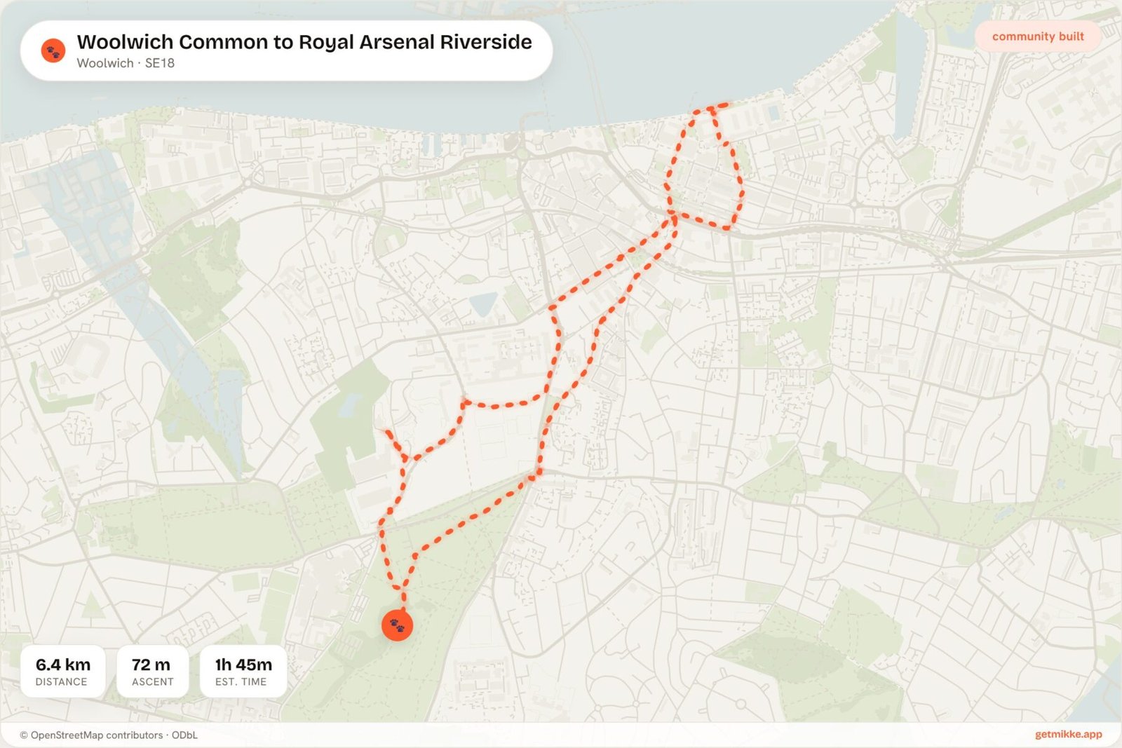
6.36 km · 72 m ascent · Mixed: rough grass and heath-like common, then urban pavements downhill to riverside, then level Thames Path; some short road sections · Check locally · Woolwich Arsenal (DLR/Elizabeth line/National Rail) · Limited near the common; paid parking at Royal Arsenal · Cafés and pubs inside the Royal Arsenal development and Woolwich town centre · mud: Moderate
This is the big day out of the list. It links two completely different worlds: the semi-wild feel of Woolwich Common up top, then a downhill drop to a polished riverside stroll at Royal Arsenal.
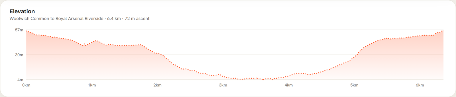
At 6.36 km it is the longest walk here, with 72 m of ascent front-loaded across the common before the ground tips downhill to the water.
The land here mixes common and private development, so off-lead status is marked check locally. No single published rule covers the whole route, so keep control on the common and lead up for the pavement and riverside sections.
Transport is excellent: Woolwich Arsenal serves the DLR, Elizabeth line and National Rail, so you can walk one way and hop back.
THE HONEST DOWNSIDE: A stretch of pavement and roadside walking connects the common to the river, plus occasional military activity around the barracks. It is not a continuous green route.
Blackheath Circuit
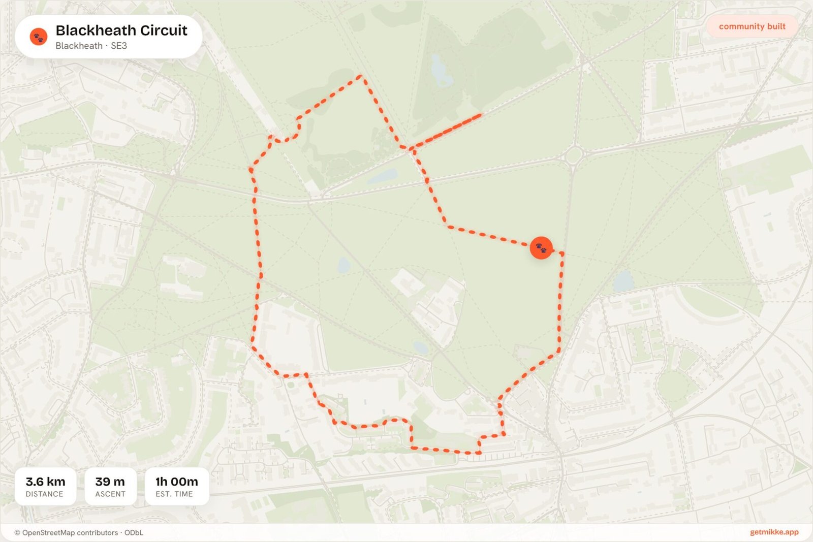
3.58 km · 39 m ascent · Open heathland, mostly grass · Check locally · Blackheath · Free roadside on Goffers Road (fills early) · None on the heath (bring your own) · mud: Low
The polar opposite of Oxleas. Where the woods are steep, dark and muddy, Blackheath is wide, flat, open grass with sight lines for miles. This is the one to pick for a big or elderly dog who wants space without the climb.
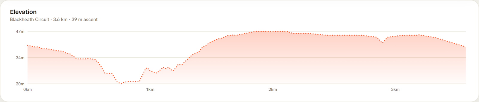
Just 39 m of rise across the whole circuit means it stays easy underfoot throughout.
Blackheath is common land, and the Royal Borough of Greenwich parks rules apply (dogs under control, four per walker). No specific Public Spaces Protection Order (PSPO) document number was found published for Blackheath itself, so off-lead status is marked check locally: read it as allowed subject to control rather than a formally mapped off-lead zone. The heath drains well, keeping mud low even after a proper soaking.
One genuine perk: free roadside parking on Goffers Road, though it fills early on weekends.
THE HONEST DOWNSIDE: Almost no shade and the A2 splits the heath, meaning two road crossings with traffic. In summer, and with a nervy dog near the road, plan your line carefully. Bring water; there is none on the heath.
Charlton Park & Hornfair Park Circuit
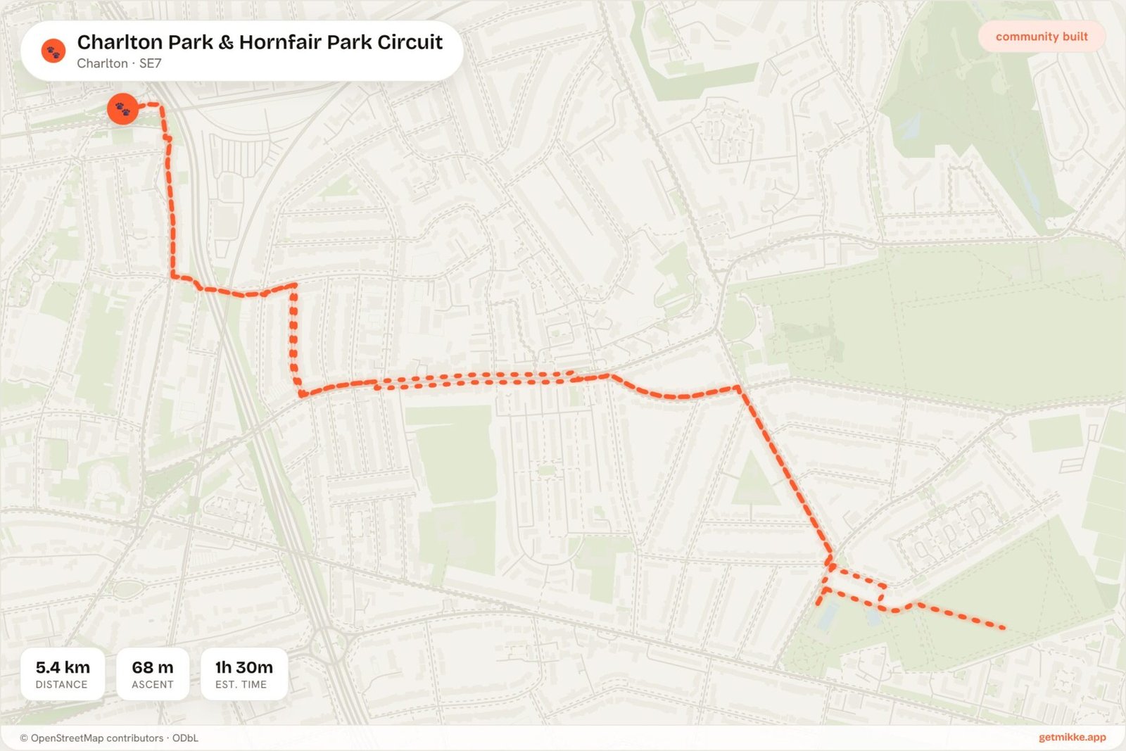
5.39 km · 68 m ascent · Mix of level tarmac paths and large flat grass areas; some gentle gradients · Check locally · Charlton · Charlton Park car park and on-street parking · Seasonal kiosk at Hornfair Park; cafés on Shooters Hill Road · mud: Low
Blackheath is open but split by a major road. Charlton Park is open and quieter, which makes it the sensible pick for a reactive dog who needs room and low footfall.
There are no stiles on the standard loops and plenty of long perimeter paths, so a bigger dog can stride out without obstacles.
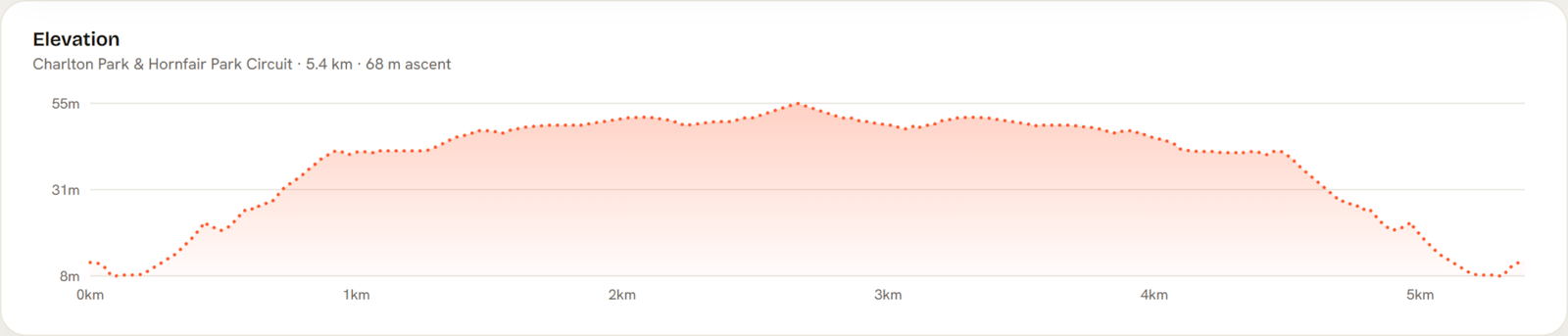
The 68 m of ascent is spread gently over 5.39 km, so the gradients are mild despite the total. It is council land with off-lead status marked check locally, so open grass reads as off-lead subject to control.
Worth flagging: during summer cricket the pitch area may become lead-only. That restriction tends to be locally signposted rather than published on the borough rules page, so watch for signs on the day.
THE HONEST DOWNSIDE: Large formal sports pitches and events can limit where you go, parts near the pool are busy and noisy, and it feels less wild than the woodland walks.
How these 8 walks compare on mud, off-lead access and climb
Quick reference before you commit. Mud ratings are practical guidance based on terrain, not an official classification.
| Walk | Distance | Ascent | Mud | Off-lead |
|---|---|---|---|---|
| Greenwich Park Loop | 2.97 km | 47 m | Low | Mixed (Royal Parks rules) |
| Thames Path: Cutty Sark to the O2 | 3.41 km | 26 m | Low | On lead (advised) |
| Maryon Park & Maryon Wilson Park Woods Loop | 3.02 km | 52 m | Moderate | Check locally |
| Eltham Park South & Shepherdleas Wood Loop | 4.2 km | 36 m | Moderate | Check locally |
| Oxleas Wood Loop | 2.47 km | 71 m | High | Check locally |
| Woolwich Common to Royal Arsenal Riverside | 6.36 km | 72 m | Moderate | Check locally |
| Blackheath Circuit | 3.58 km | 39 m | Low | Check locally |
| Charlton Park & Hornfair Park Circuit | 5.39 km | 68 m | Low | Check locally |
Key Takeaway: For low mud and easy ground, pick Blackheath or the Thames Path. For a woodland workout, Oxleas earns its high mud rating. For a nervous dog, Charlton Park gives space without the crowds.
Pin any of these eight Greenwich routes in Mikke and follow the exact geometry on your phone, mud rating and all.
Get Mikke free → Community-built dog walking routes · free on iOS and AndroidFAQs: off-lead rules, parking and seasonal restrictions in Greenwich
Can dogs go off-lead in Greenwich Park?
Generally yes. Under the Royal Parks and Other Open Spaces Regulations 1997, dogs do not need to be on a lead in Greenwich Park, provided you keep them under effective control (royalparks.org.uk). The Flower Garden, Wilderness Deer Paddock and Royal Observatory Garden are no-dogs zones, not off-lead areas.
Are there restrictions on dogs in Greenwich Park during autumn?
The deer paddock is a permanent no-dogs area. The Royal Parks also advises avoiding the deer area during the autumn rut (roughly September to November). This is risk-management guidance rather than a written byelaw, so check current signage on the day.
Is Blackheath common good for off-lead dog walking?
It is open, flat and drains well, so mud stays low even after heavy rain. Access falls under the Royal Borough of Greenwich’s general park rules (royalgreenwich.gov.uk). No specific Public Spaces Protection Order (PSPO) document number for Blackheath itself was found published there, so treat it as off-lead subject to control and check locally.
Where can I park for free when walking a dog in Greenwich?
Blackheath offers free roadside bays on Goffers Road, though they fill early. Greenwich Park has only limited paid pay-and-display parking off Blackheath Gate. Most other walks rely on on-street parking, so check local signs for CPZ restrictions.
Do any Greenwich dog walks have stiles that are hard for big dogs?
No. Oxleas Wood and Charlton Park both use standard gates rather than stiles on their usual routes, which suits large, older or arthritic dogs. The urban park and riverside walks here use gates, steps and ramps too.
Is the Thames Path in Greenwich dog-friendly for pushchairs and prams?
Yes, it is the best option here for prams. The Cutty Sark to the O2 stretch is fully surfaced and almost flat, with only 26 m of ascent. Keep your dog on the lead near cyclists and joggers.
Are there seasonal restrictions on dog walks in Greenwich or Charlton Park?
Greenwich Park has the autumn deer-rut advice around the paddock. Charlton Park’s cricket pitch area may become lead-only during summer matches. That cricket rule is usually signposted locally rather than published online, so look for signs before letting your dog off.
Final thoughts
Greenwich rewards you for matching the walk to the day. On a wet Tuesday, take the Thames Path or Blackheath and stay clean. On a dry weekend with energy to burn, Oxleas and Woolwich Common give a dog something to really get stuck into.
Carry water in warm weather, respect the no-dogs zones in the Royal Park, and read the signs on council land where off-lead status is still marked check locally.
Download Mikke to open all eight Greenwich walks with turn-by-turn routing, so you always know the mud, the climb and the off-lead rules before you set off.
Get Mikke free → Community-built dog walking routes · free on iOS and Android